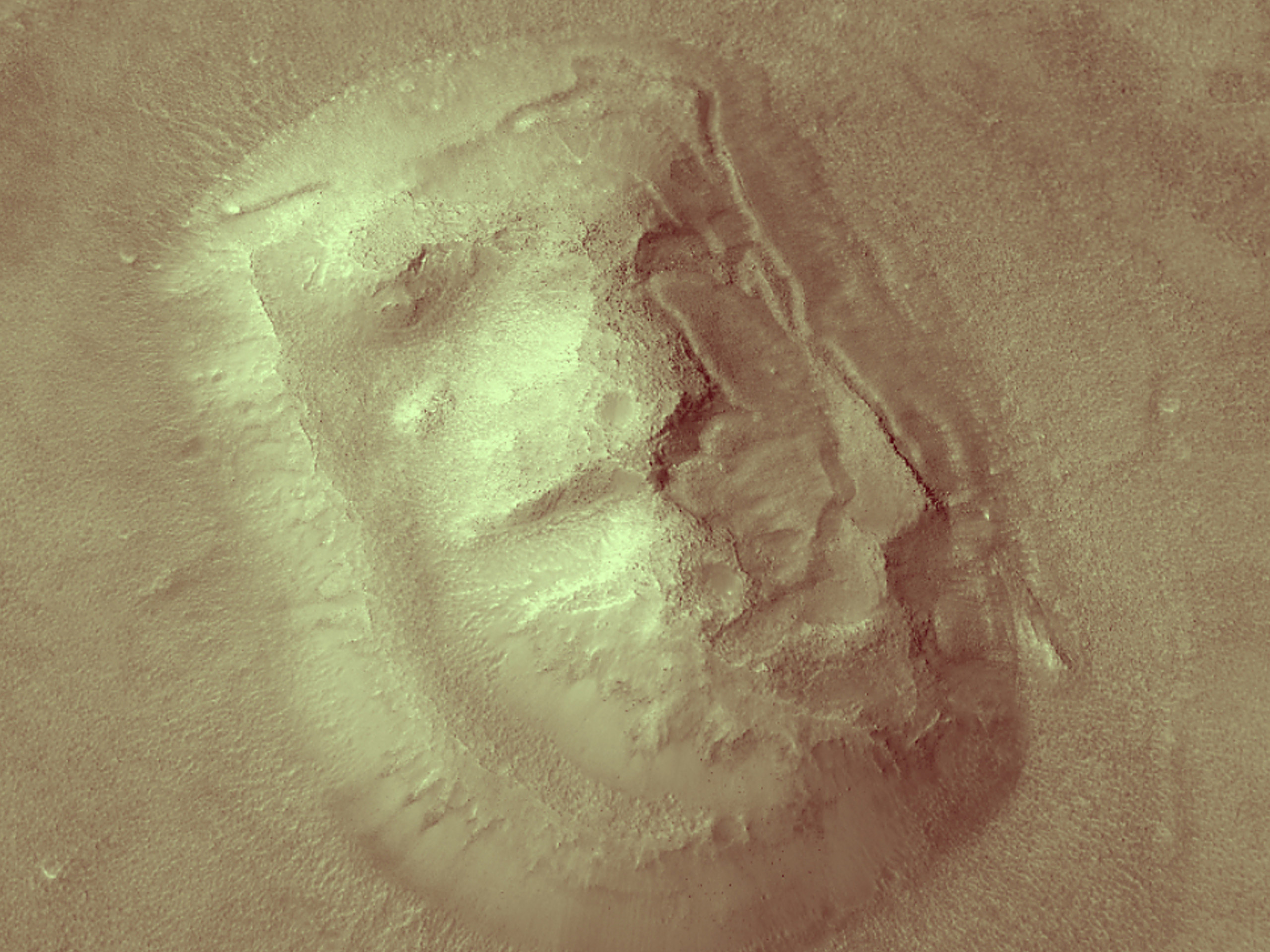
This particular mesa acquired a certain notoriety when an image was captured by the Viking 1 orbiter on 25 July 1976. The shadows cast across the feature created a pareidolic perception of a human face. This feature became one of the most famous examples of a “mimetolith,” a pattern created by rocks that may come to mimic recognizable forms through the random processes of formation, weathering and erosion.
Scattered mesas, such as this one, are common in the Cydonia region, where the heavily cratered Southern highlands of Mars transition into the smooth Northern lowlands. Many midlatitude locations like this have also experienced glacial activity, which probably reduced the size of this mesa and created the stubby valleys around its highest level. Patches of smooth material (especially on its east- and north-facing sides) are likely to be remnants of dusty water ice.
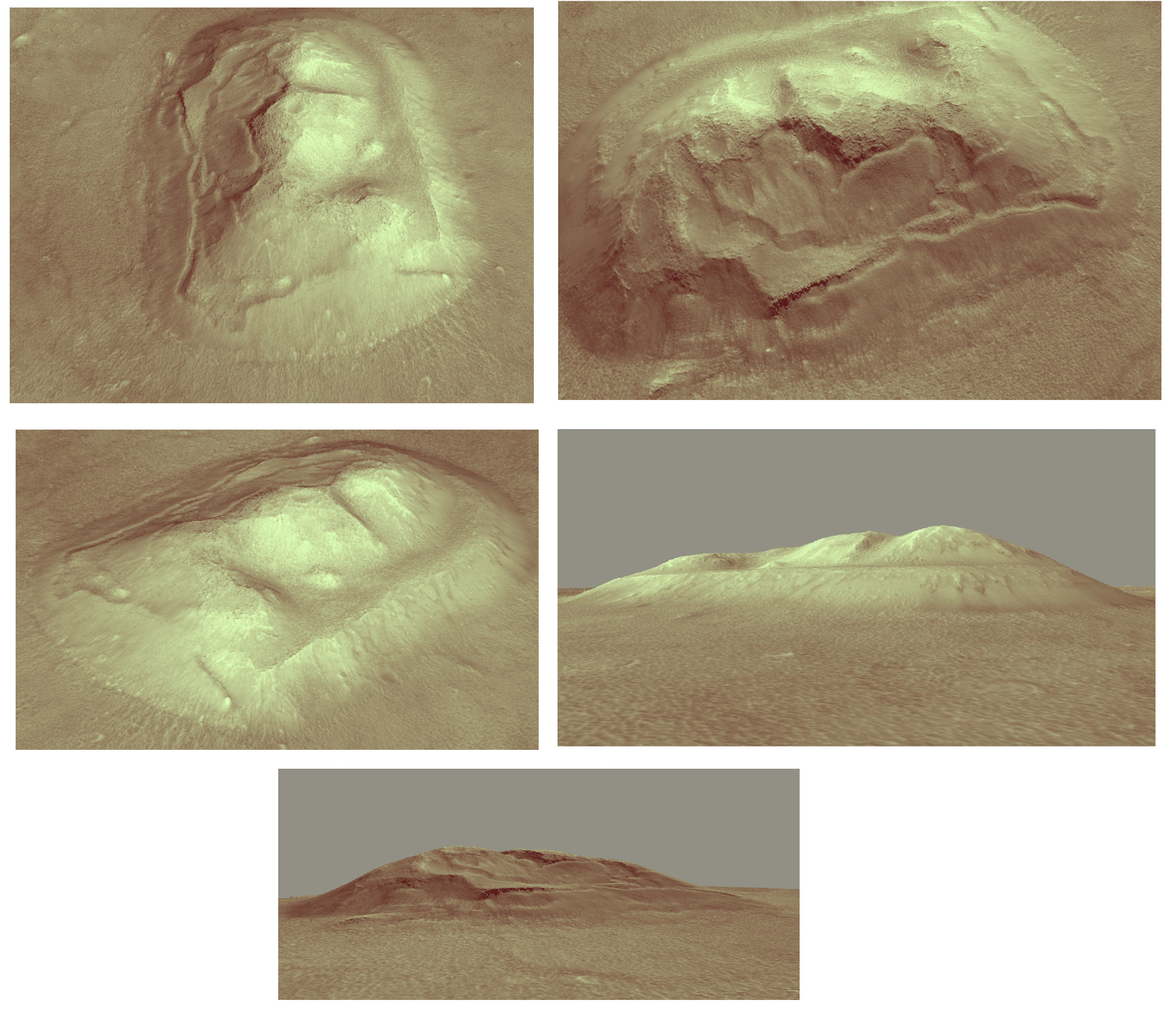
A stereo pair of this feature taken by HiRISE was turned
into a digital terrain model. HiRISE DTMs are made from two images of the same area on the ground, taken from different angles, on different orbits. HiRISE DTMs provide valuable data, not only for researchers, but also for visualizing the terrain.
For example, with the DTM we can recreate the shadows on the day
of the original 1976 Viking image. By modeling the sun angle as it would have appeared on 25 July 1976 throughout the day, the features of the mimetolith only take shape
when the lighting is lowest just before sunset.
This video and
color perspective views were created by our team using the DTM data input into open source visualization software. Visualizations such as these provide an accurate view of what could be seen by a ground-based or aerial explorer.
ID:
ESP_080970_2210date: 4 November 2023
altitude: 299 km
https://uahirise.org/hipod/ESP_080970_2210
NASA/JPL-Caltech/University of Arizona
#Mars #science #NASA