AutoTriangulation is a standalone program that is intended to assist in controlling stereo pairs to laser altimetry.
It was developed at the HiRISE Operations Center for use with HiRISE for digital terrain model (DTM) production within the ISIS/SOCET SET pipeline. However, it is generic in that it
can be used with LROC, CTX, MDIS, or any other similar data, with some constraints.
AutoTriangulation is currently not applicable to projects made in polar stereographic projection.
The inputs are a DTM in GeoTIFF format, which can be output from SOCET SET, a data set of laser altimetry (shots, or tracks, not gridded data), and the SOCET SET multi-sensor triangulation (MST)
report or ground point file.
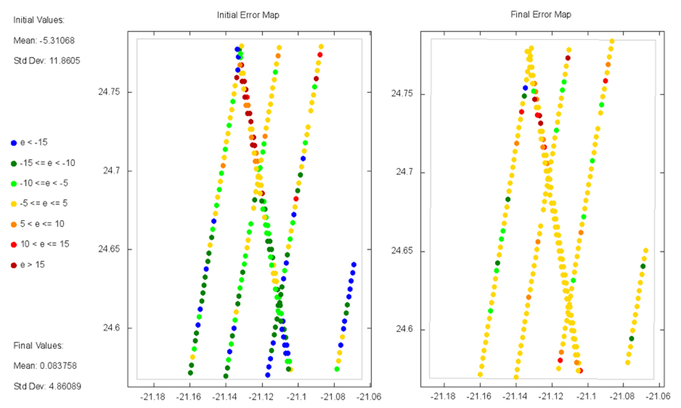
The main outputs are a best fit solution and figures showing the initial state of the correspondence between the DTM and the laser altimetry, and a predicted state based on
the solution found by autoTriangulation. Optionally, the user can update the ground point file in SOCET SET with the transformation from autoTriangulation.
An installer executable is provided which is compatible with Microsoft Windows XP - Windows 8 platforms (tested on Windows 7). It will install autoTriangulation and any dependencies.
Please see the included user’s manual for more details.
Direct questions about autoTriangulation
using our contact page.
*Note: Install software at your own risk. HiRISE and the University of Arizona are not liable for any issues arising from the use of the HiRISE website or any downloadable software.