|
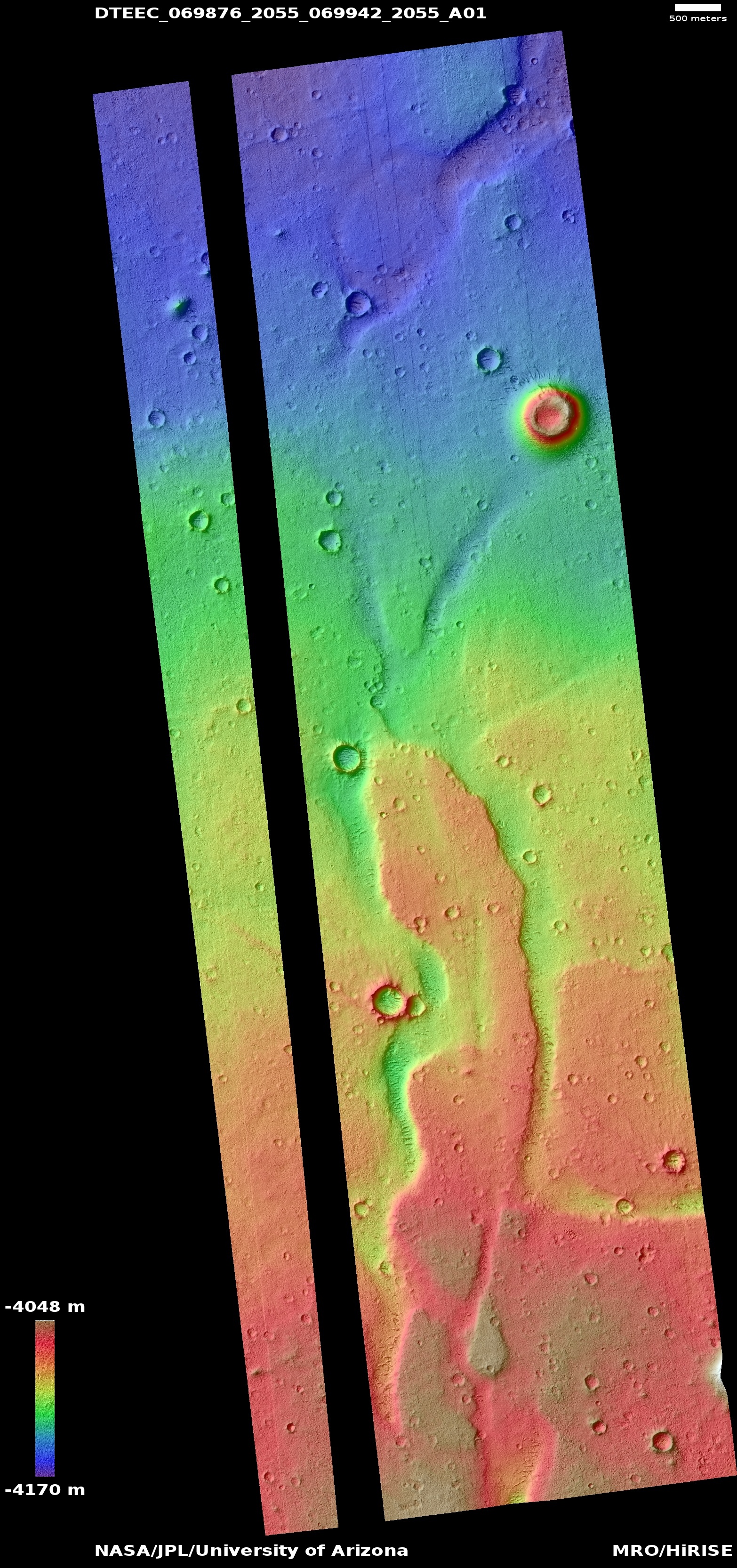
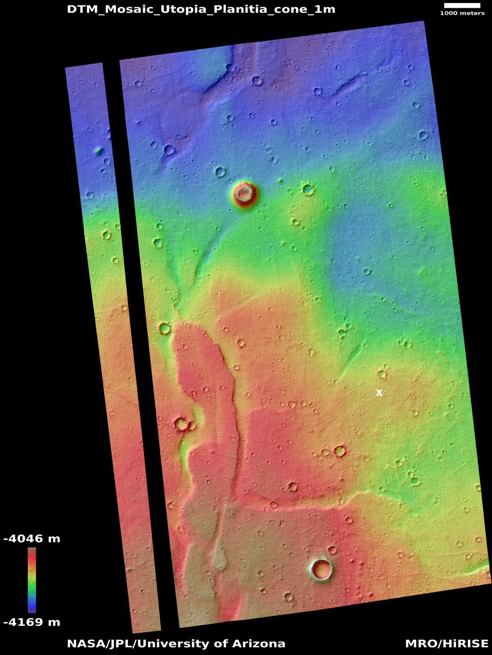
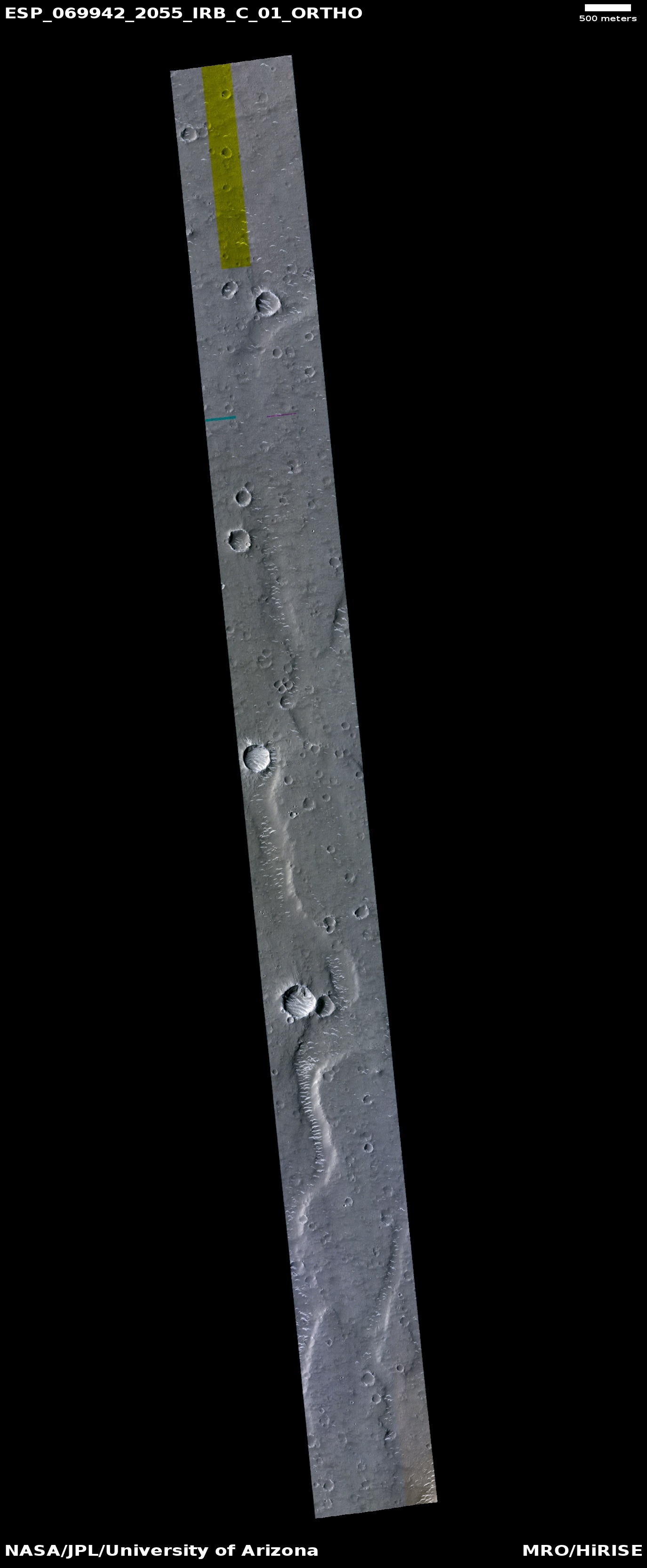
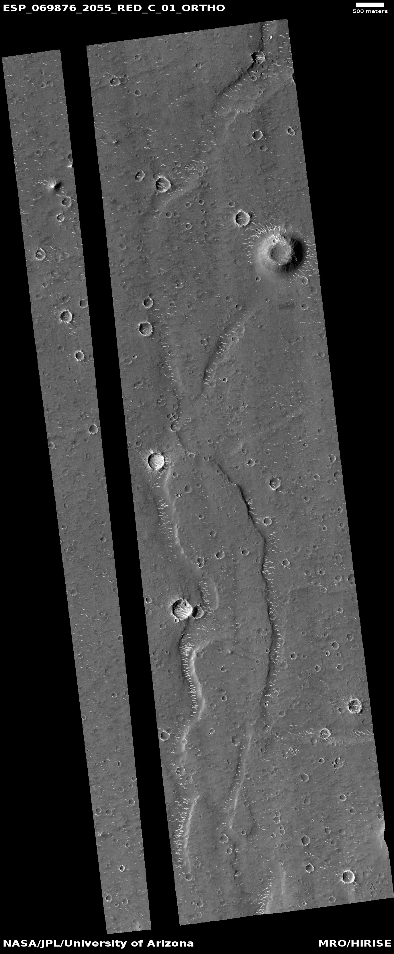
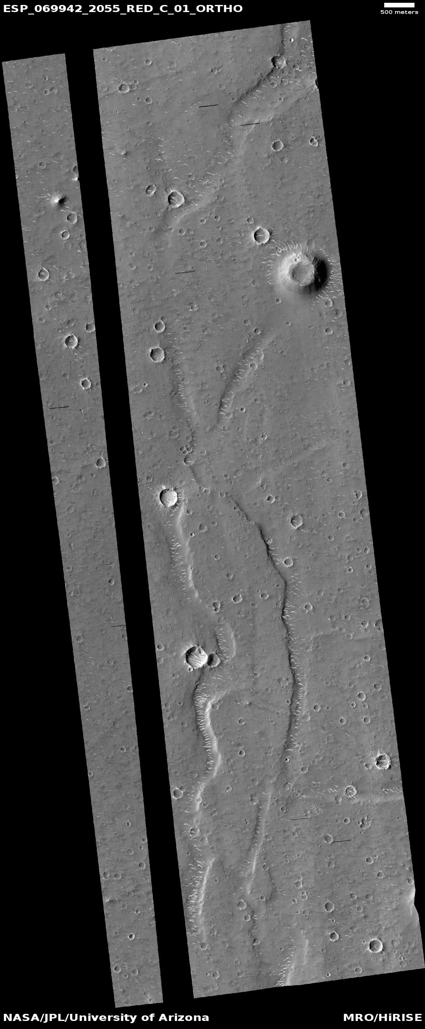
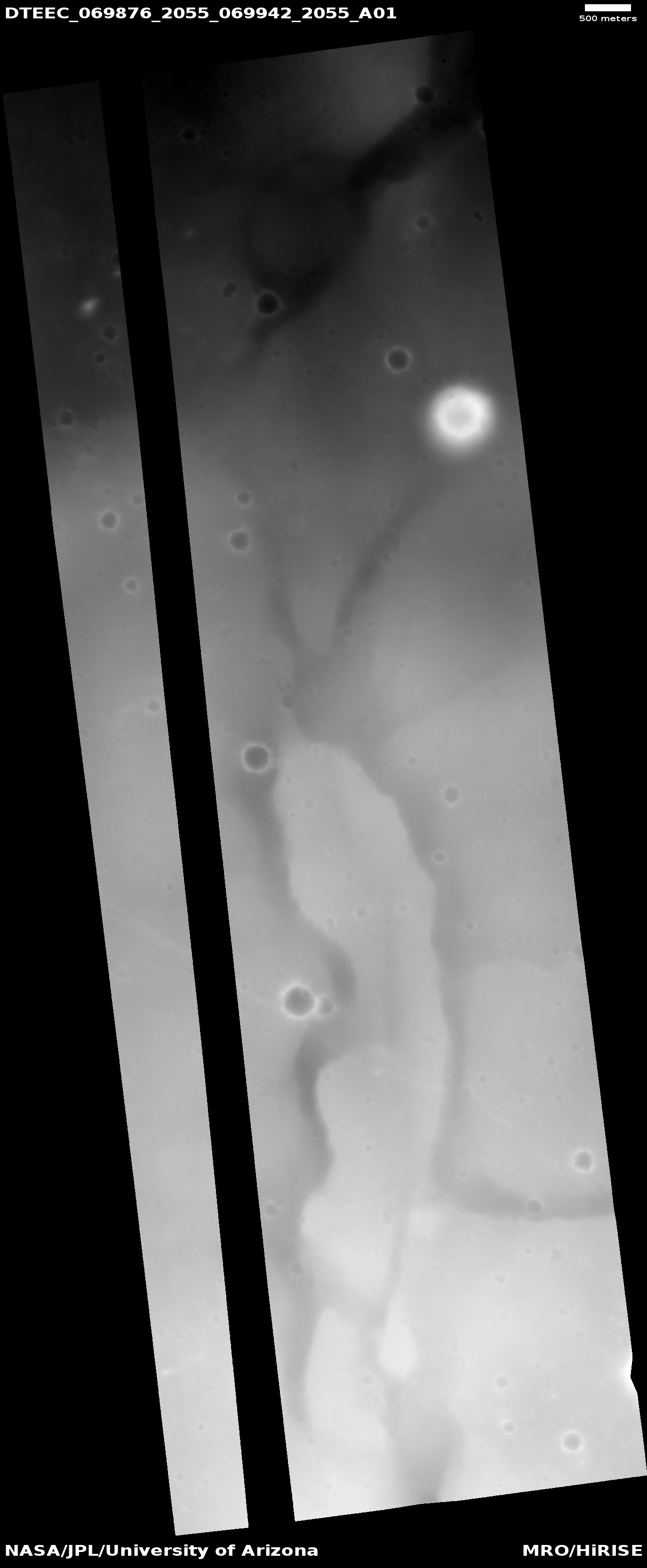
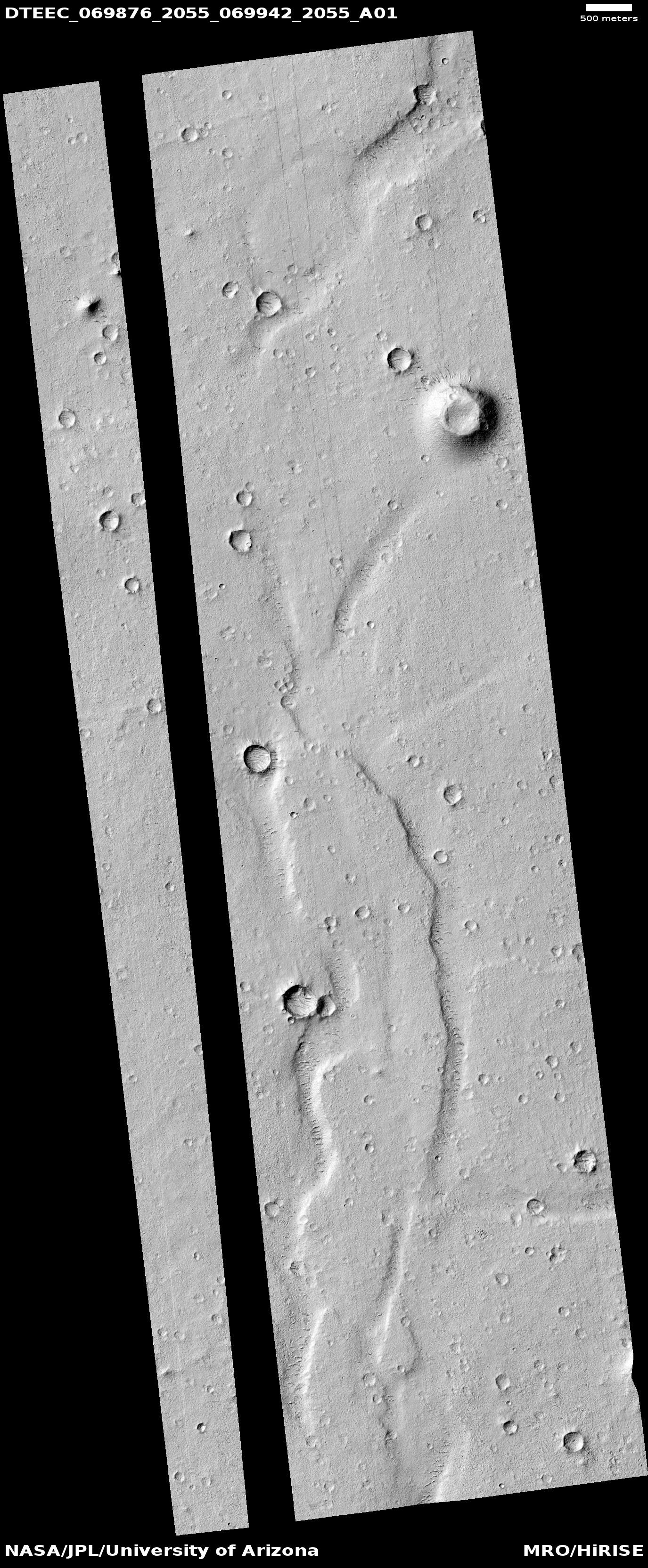
DTM & ORTHOIMAGES DTEEC_069876_2055_069942_2055_A01 (451 MB) ESP_069942_2055_RED_C_01_ORTHO (31 MB) ESP_069942_2055_IRB_C_01_ORTHO (16 MB) ESP_069942_2055_RED_A_01_ORTHO (418 MB) ESP_069942_2055_IRB_A_01_ORTHO (224 MB) ESP_069876_2055_RED_C_01_ORTHO (33 MB) ESP_069876_2055_RED_A_01_ORTHO (481 MB) Full directory listing |
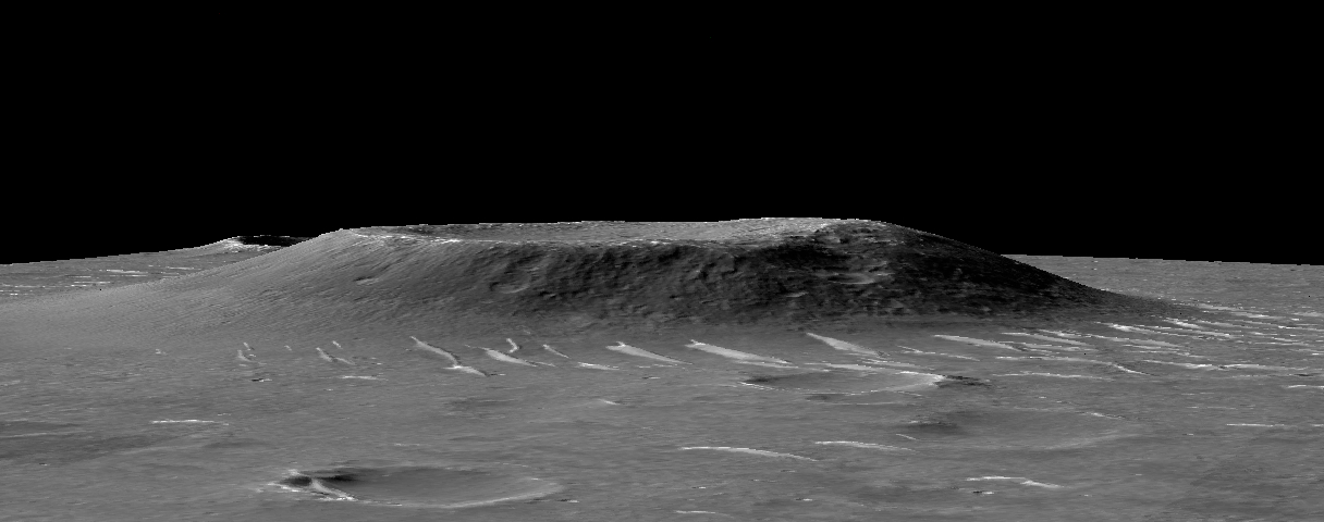
DTM EXTRAS ESP_069942_2055_IRB_C_01_ORTHO (Annotated Browse) ESP_069876_2055_RED_C_01_ORTHO (Annotated Browse) ESP_069942_2055_RED_C_01_ORTHO (Annotated Browse) DTEEC_069876_2055_069942_2055_A01 (Annotated Browse) DTEEC_069876_2055_069942_2055_A01 (Shaded Relief) DTEEC_069876_2055_069942_2055_A01 (Color Altimetry) Extras Read me Extras directory listing |
STEREO PAIR Left observation ESP_069876_2055 Right observation ESP_069942_2055 Latitude (center) 25.09° Longitude (center) 109.8° Map scale 1.00 meter/pixel North azimuth 270° RESOURCES About DTMs How to use DTMs |
|
Home About Catalog Outreach Science Updates Anaglyphs DTM HiView HiWish Map Press Science Nuggets Special Releases Stereo Pairs HiKERs |
Advanced Search Captions Contact FAQ Image Usage Policy 4 Q&A HiCards HiClips HiFlyers HiPOD Made with HiRISE MarsPoetica Social Media Map The BeautifulMars eBook Series The BeautifulMars Podcast Our Volunteers |
Camera Specs CTX Directory PDS Directory Science Themes Software Lunar & Planetary Laboratory PIRL College of Science University of Arizona MRO NASA/JPL Planet Four |
High Resolution Imaging Science Experiment HiRISE Operations Center 1541 E. University Blvd Tucson, Arizona 85721 © 2026 Arizona Board of Regents University Information Security and Privacy |