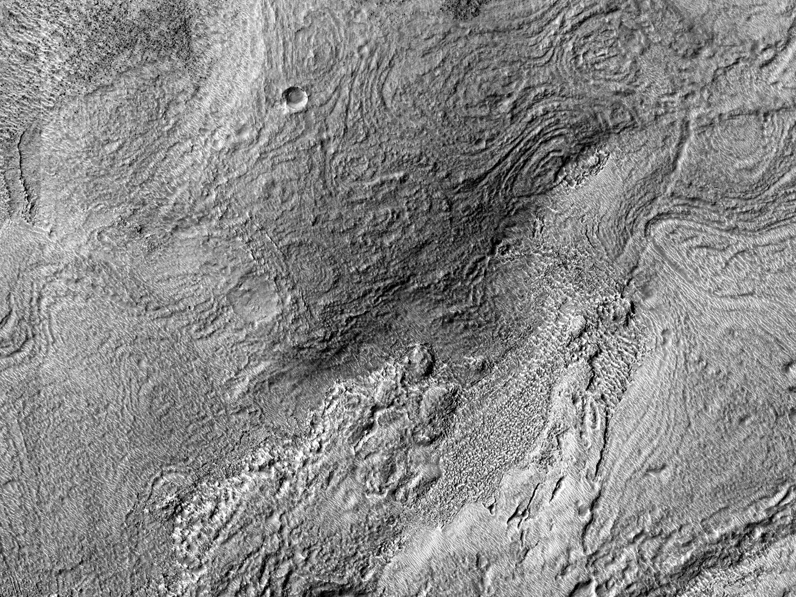
| Bands and Ridges near Harmakhis Vallis
The objective of this observation is to examine a field of curved bands and ridges. This may be honeycomb terrain. Harmakhis Vallis is an approximately 800-kilometer long outflow channel located in eastern Hellas. The valley probably formed by a combination of surface collapse and flowing water. |
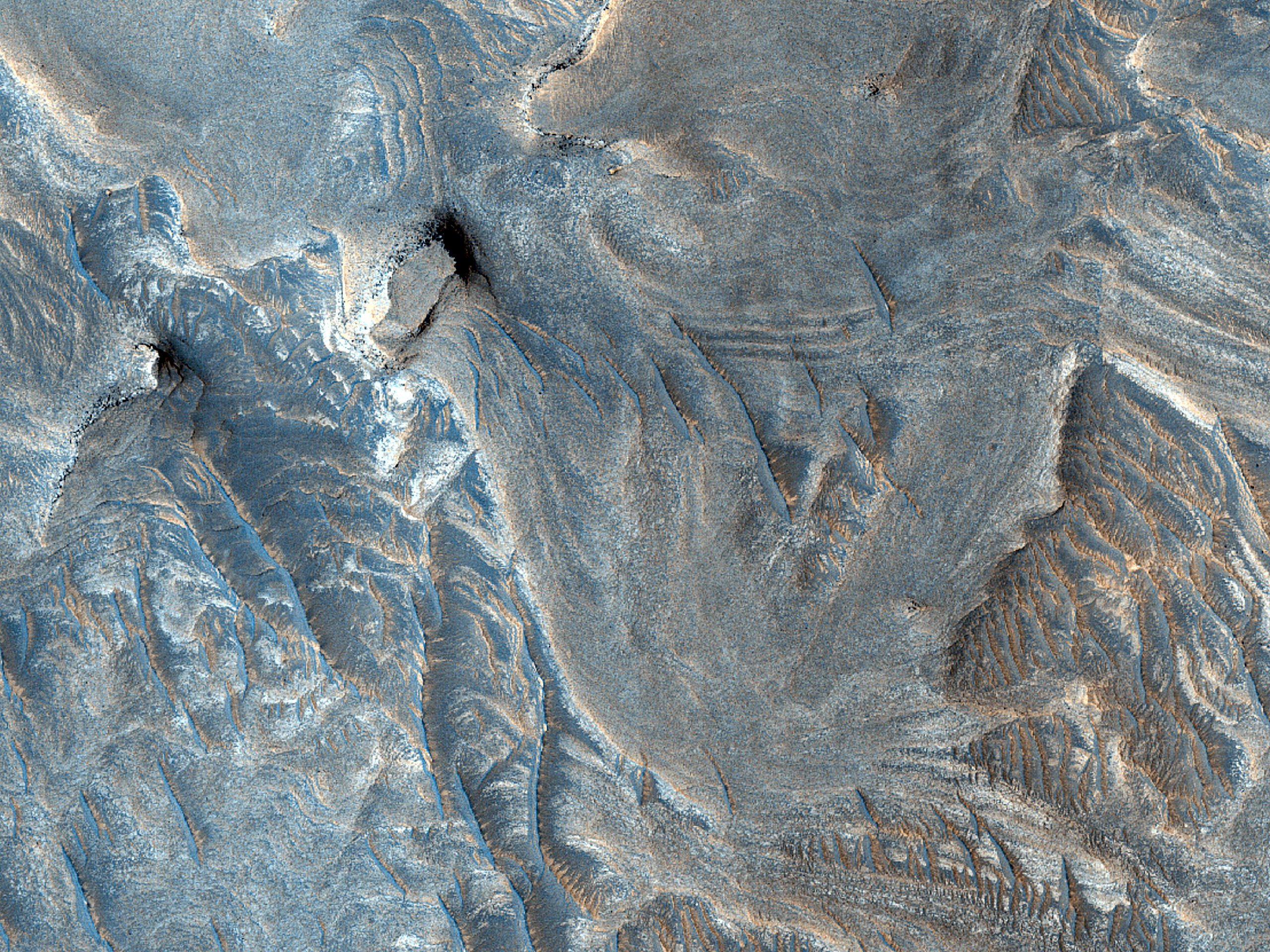
| Layered Material in Juventae Chasma
This image shows light-toned layered rock (sedimentary?) outcrops with spectacular erosional expressions that might (or not) give good clues on depositional setting. Were these sediments deposited here *after* Juventae Chasma opened up, or are they exhumed features, exposed by the opening and subsequent modification of the chasm? Can we tell? | 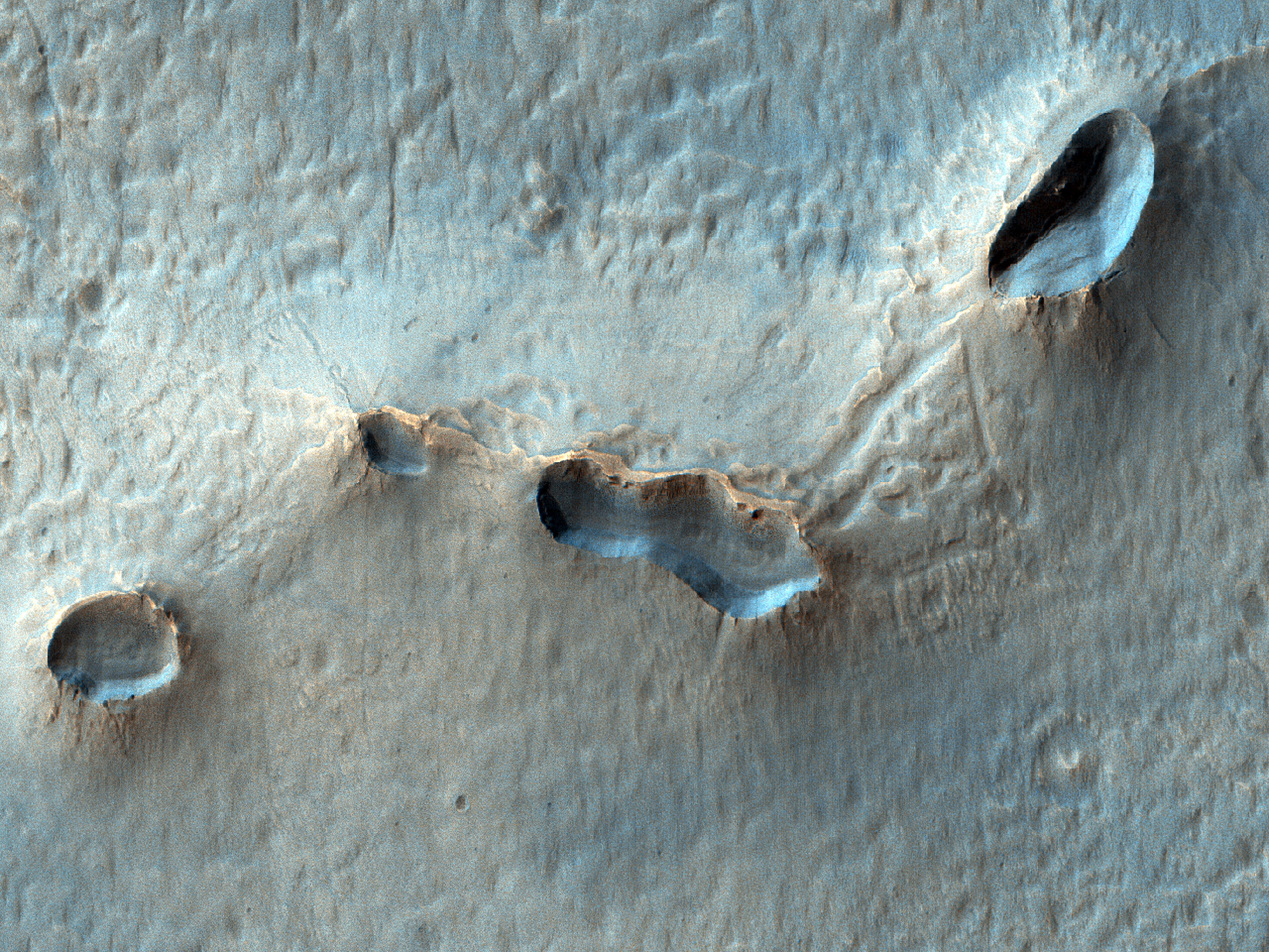
| Bright Patches in Terra Sirenum
This observation is a good example of when different missions work together: the CaSSIS instrument on the ExoMars Trace Gas Orbiter identified here 10-meter scale bright patches on irregular collapse feature rims. An example of a location with possible mud volcanism? An image at HiRISE resolution can help to answer that question. | 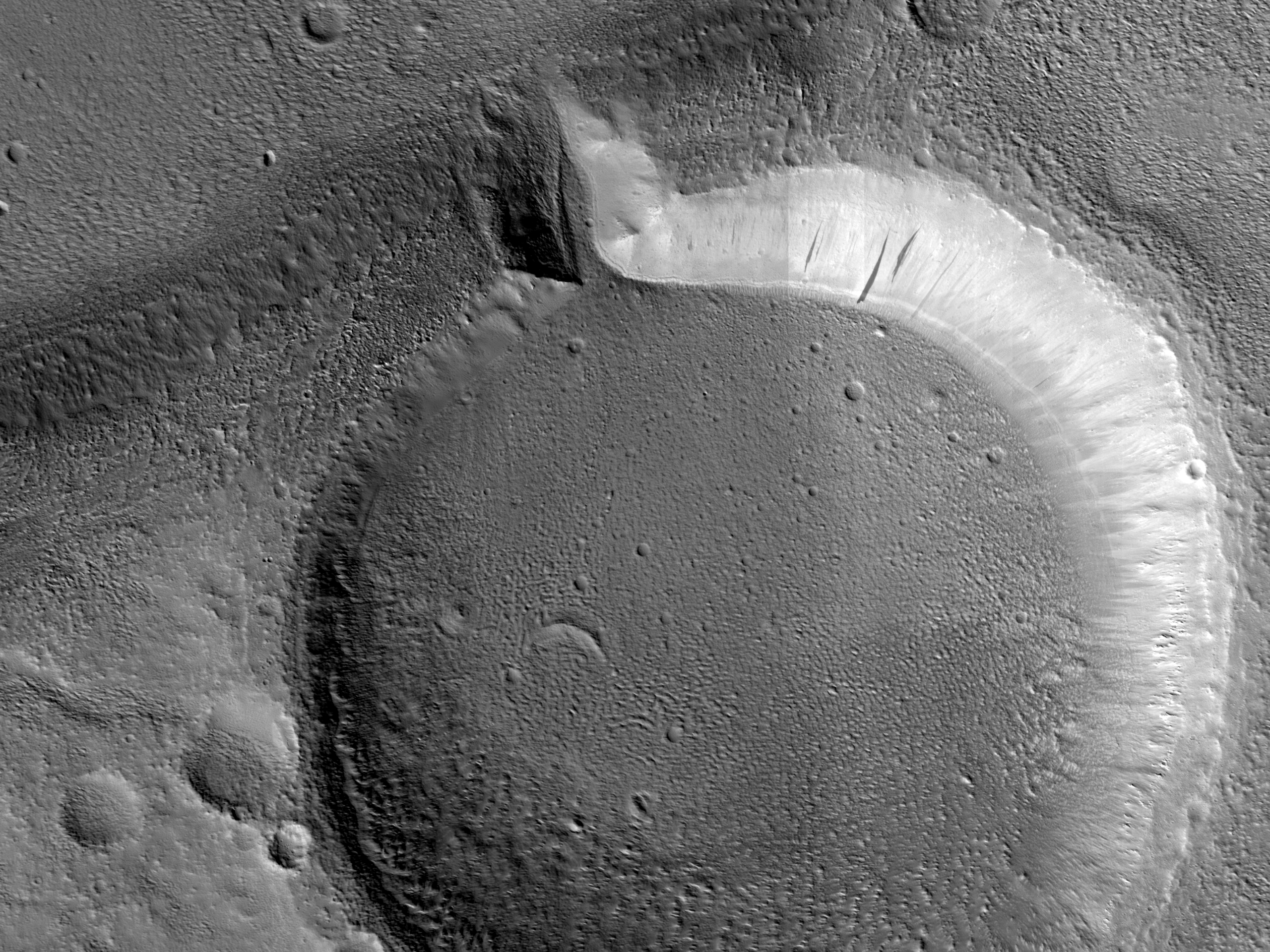
| Every Crater Needs an Outlet
This image shows an impact crater with icy-looking fill and a curious outlet notch, feeding into another smooth, possibly-icy deposit in the valley below. The topography should be interesting in high resolution, including looking for boulders and polygons. | 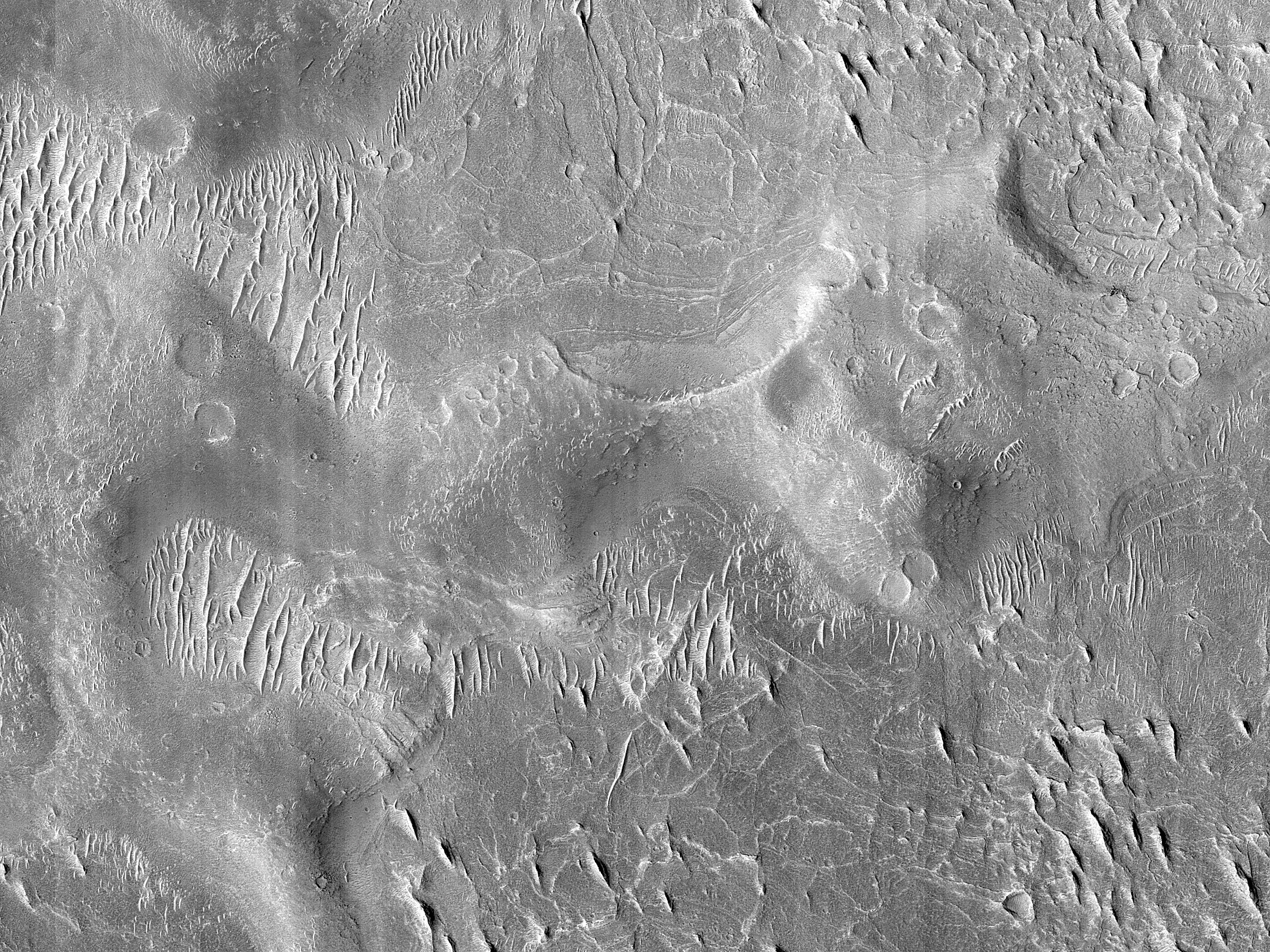
| Layers in Aeolis
Also available in Context Camera image data, the objective of this observation is to examine layers at the base of mounds The extensive network of ridges in the Aeolis region is interpreted as having formed by topographic inversion of fluvial and alluvial deposits. |