|
IMAGE PRODUCTS Map projected reduced-resolution (PNG) Full resolution JPEG2000 USAGE POLICY All of the images produced by HiRISE and accessible on this site are within the public domain: there are no restrictions on their usage by anyone in the public, including news or science organizations. We do ask for a credit line where possible: NASA/JPL/University of Arizona |
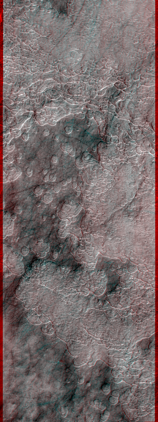
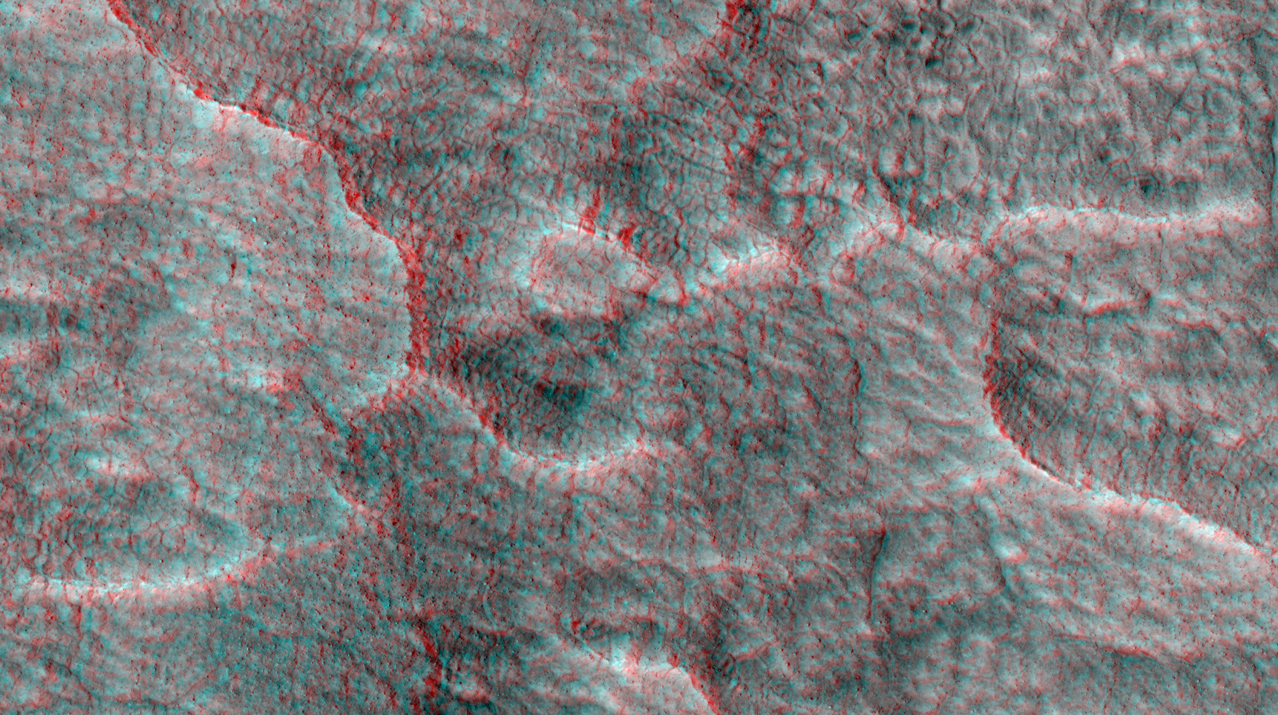
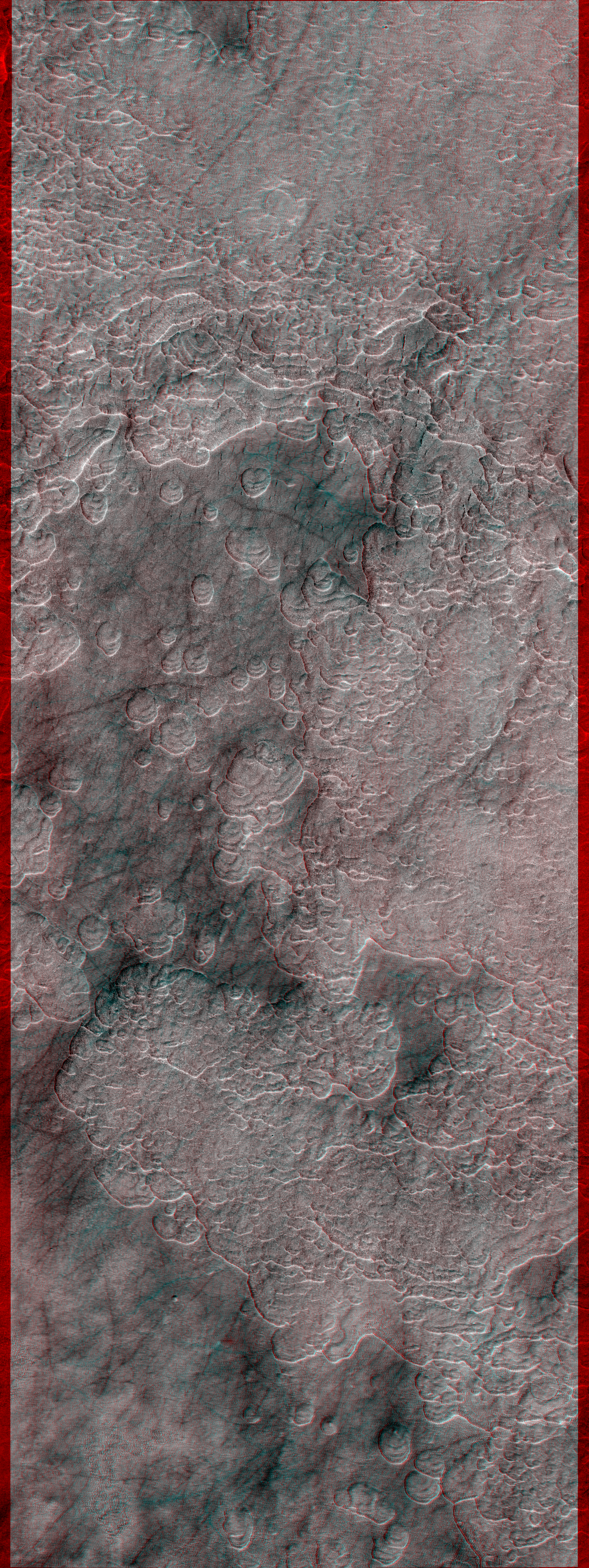
STEREO PAIR Left observation ESP_025620_2275 Right observation ESP_025277_2275 Contrast stretch NONLINEAR Convergence angle 29.9 degrees Image lines 60539 Line samples 22749 |
RESOURCES
About anaglyph products (PDF) POSTSCRIPT NASA’s Jet Propulsion Laboratory, a division of the California Institute of Technology in Pasadena, Calif., manages the Mars Reconnaissance Orbiter for NASA’s Science Mission Directorate, Washington. The HiRISE camera was built by Ball Aerospace and Technology Corporation and is operated by the University of Arizona. |
|
Home About Catalog Outreach Science Updates Anaglyphs DTM HiView HiWish Map Press Science Nuggets Special Releases Stereo Pairs HiKERs |
Advanced Search Captions Contact FAQ Image Usage Policy 4 Q&A HiCards HiClips HiFlyers HiPOD Made with HiRISE MarsPoetica Social Media Map The BeautifulMars eBook Series The BeautifulMars Podcast Our Volunteers |
Camera Specs CTX Directory PDS Directory Science Themes Software Lunar & Planetary Laboratory PIRL College of Science University of Arizona MRO NASA/JPL Planet Four |
High Resolution Imaging Science Experiment HiRISE Operations Center 1541 E. University Blvd Tucson, Arizona 85721 © 2024 Arizona Board of Regents |